1 / 5
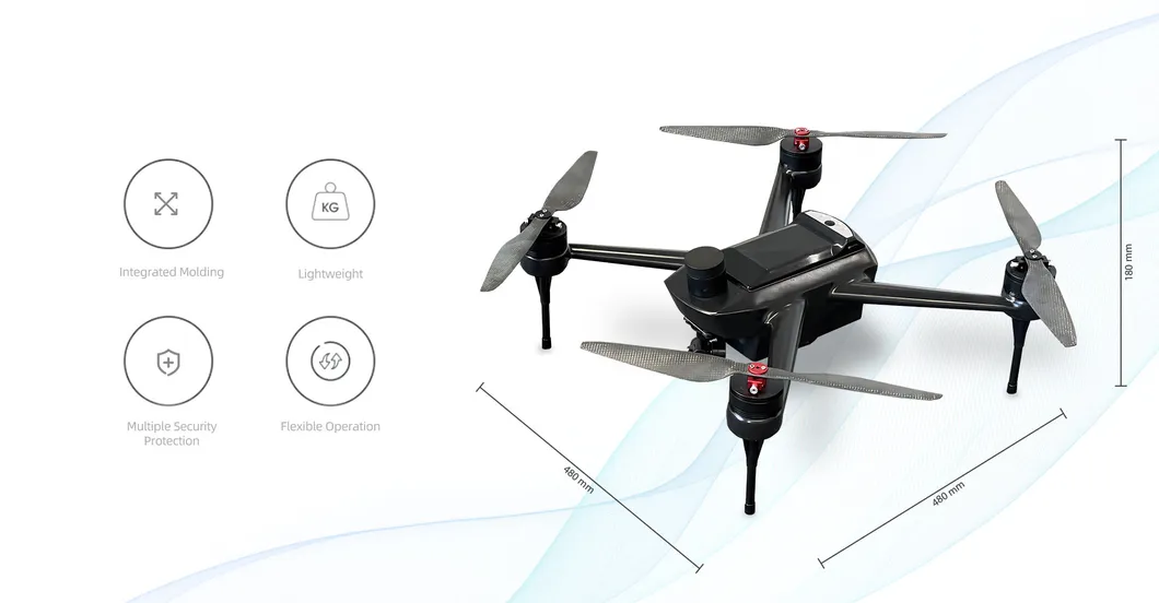
| Model | HZH C441 |
|---|---|
| Category | Wing UAV (Industrial Usage) |
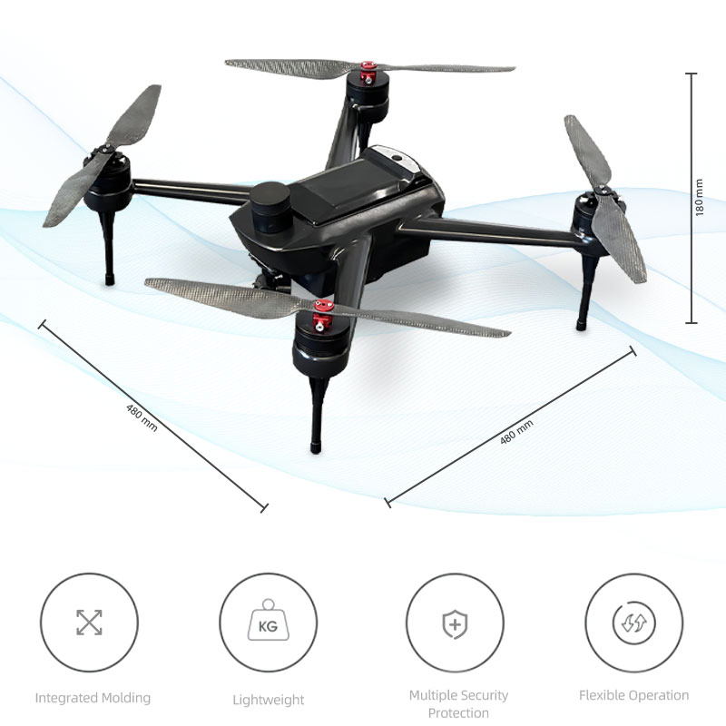
| Size (Unfold) | 480*480*180 mm |
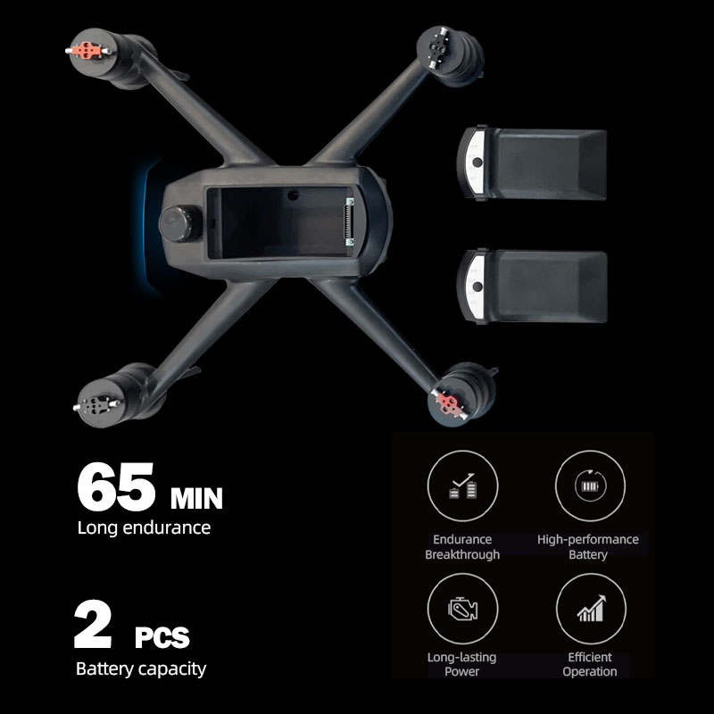
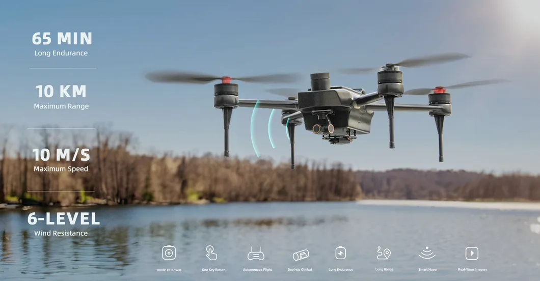
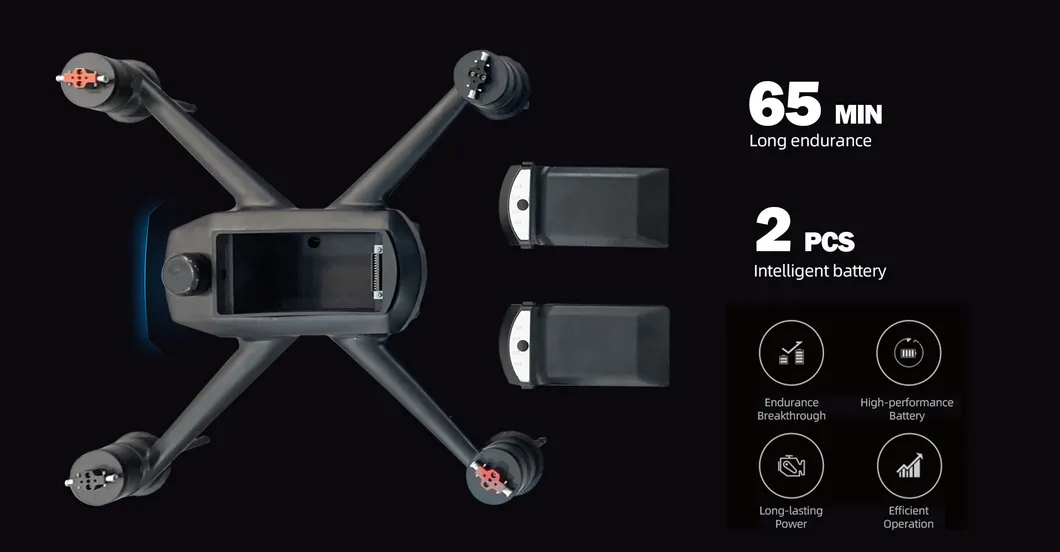
| Endurance | Max 65 Minutes |
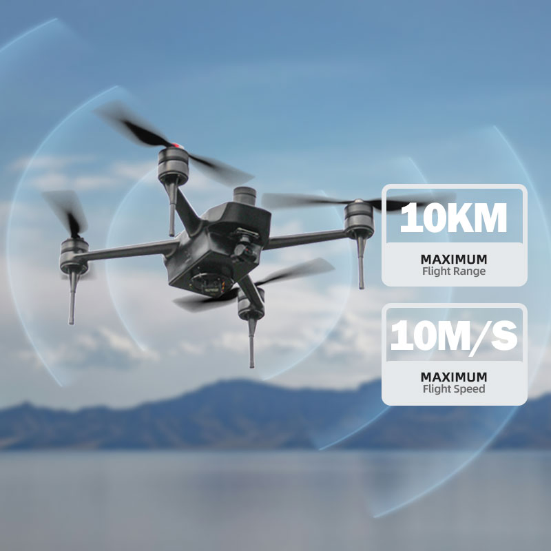
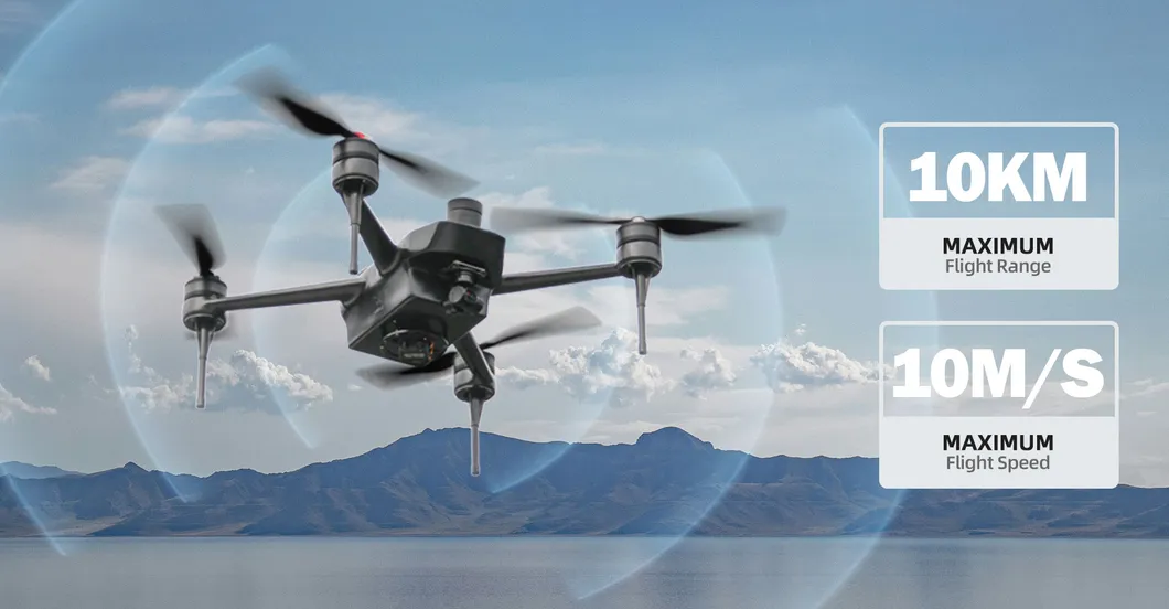
| Maximum Range | ≥10km |
| Aircraft Weight | 2.3 Kg |
| Rotor Count | 4 |
| Material | Carbon Fiber + Aviation Aluminum |
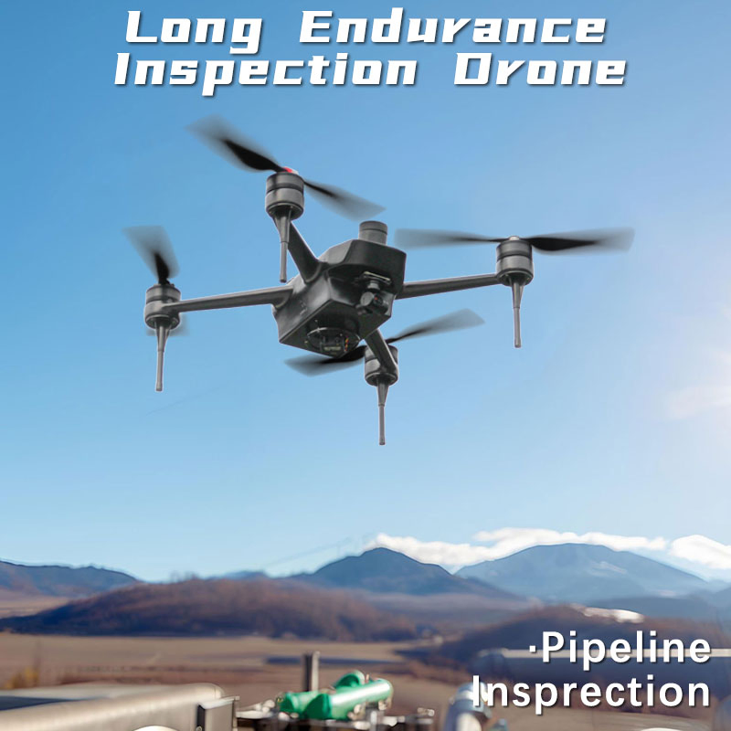
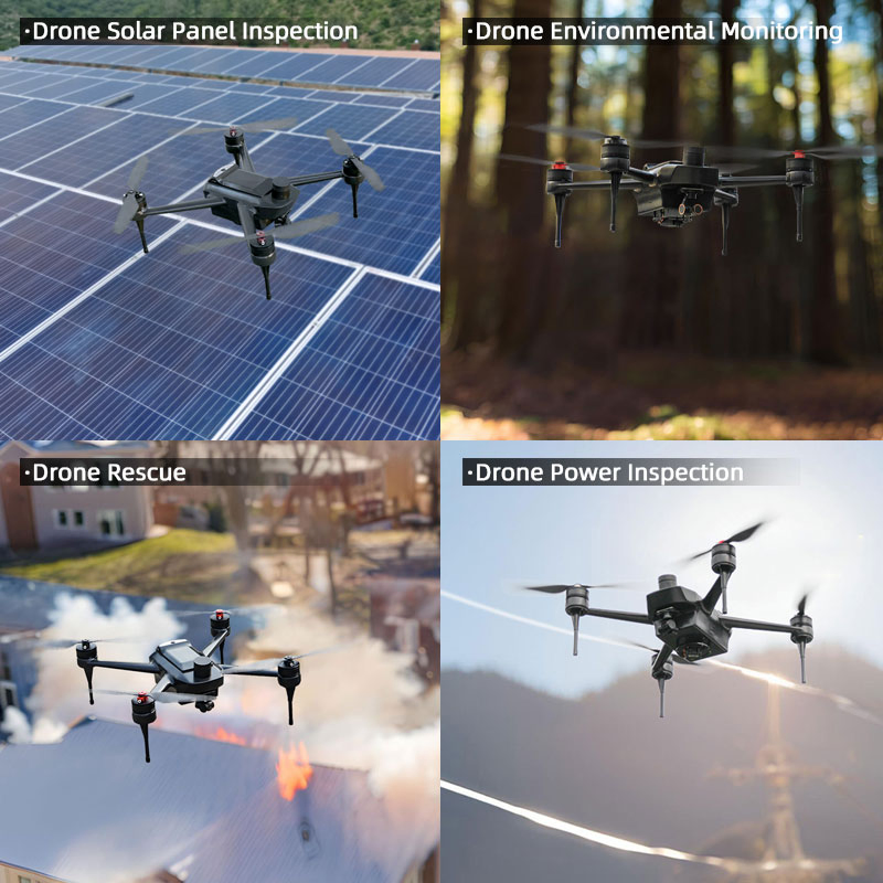
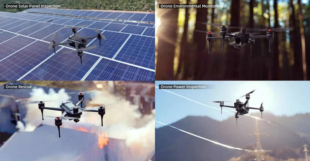
The HZH C441 inspection drone combines lightweight design, advanced features, and ease of use. It is the perfect choice for professionals looking to enhance inspection capabilities with cutting-edge surveillance technology.
| Technical Performance | |
|---|---|
| Max Takeoff Weight | ≤ 6.5kg |
| Max Climb Speed | ≥ 5 m/s |
| Max Descent Speed | ≥ 6 m/s |
| Max Flight Speed | ≥ 10 m/s |
| Wind Resistance | Level 6 |
| Positioning Accuracy | Approx. 5 cm |
| Navigation | Dual-frequency GPS (Dual Anti-magnetic Compass) |
| Task Mode | Fully Automatic |
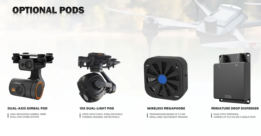
| Dual-Axis Gimbal Pod | 1080P High-Definition Camera, Multi-Angle stabilization. |
|---|---|
| 10x Dual-light Pod | 4MP CMOS + Thermal Imaging (256*192 pixels). |
| Megaphone | 3-5 km transmission range, clear sound quality. |
| Drop Dispenser | Dual path throwing, carries up to 2 kg per path. |